Flying corporate helicopters for clients in the UK and EU neccessitated having a constantly updated, easily accessible data base of available landing sites. This was critical in case some one or a new pilot had to go in at a moments notice. This lead to a standardised multi season constantly updated (with seasonal and light / dark) reference document with constantly updated photographs and pilots comments.


I reckon its a top idea. There's some good info in the back of wises maps (mayvbe even phone books too?) on ramps available around the place and includes some basic details on them - gradient, surface, tidal access etc. This could provide a good base for further development with pics and info like Bill has suggested.


 loryda wrote: loryda wrote:Plow - Sorry mate but i think that's a terrible attitude to take, sure you can keep your fishing sites to yourself but the point i believe of this is more for safety than as an invite for masses of people.. |


Lake fishing strong July is close to an end, our duck season is closing this... Read More >
Inshore snapper fishing heating up It’s officially past the halfway point of winter, and the... Read More >
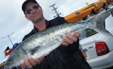
Winter kahawai abound Kahawai and kingfish have ‘invaded’ Bream Bay over the last few weeks,... Read More >
Choose a spot and stick with it Why the chill factor of the wind affects... Read More >
Options Galore at Great Barrier The outlook for this weekend looks pretty dire for heading... Read More >
Fat snapper in 70-80m The excellent winter snapper fishing continues out wide in 70-80m. These... Read More >


Major Bites
Minor Bites
Major Bites
Minor Bites

 Forum Topics
 New Posts
 Search
 FAQ
FAQ Register
 Login
Login


 Topic Options
 Post Options
") Likes(0)
Likes(0)