Missing Chart Area Raglan (Back Harbour)
Printed From: The Fishing Website
Category: General Forums
Forum Name: Tech Topics
Forum Description: IT - Computers, software, phones, ISP's....
URL: https://www.fishing.net.nz/forum/forum_posts.asp?TID=137498
Printed Date: 27 Jul 2026 at 10:21pm
Topic: Missing Chart Area Raglan (Back Harbour)
Posted By: Pannie_Dropper
Subject: Missing Chart Area Raglan (Back Harbour)
Date Posted: 03 Mar 2023 at 6:31pm
|
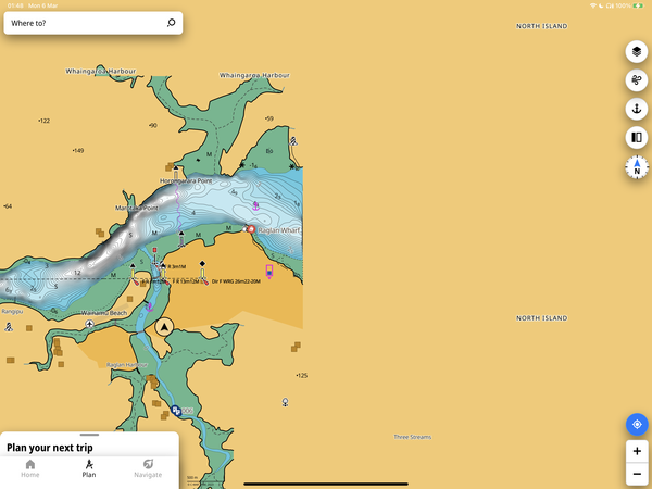
Howdy all, I have a Lowrance Elite 7 on the good ship Pannie Dropper, and when I’m heading the Raglan back harbour area I seem to go off the edge of the world. The chart detail stops at the wharf ramp pretty much. I suppose the e-chart is based on the actual admiralty charts for the harbour which cover the same area. Does anyone know how to get any chart info to display for further up the harbour? Even if it doesn’t have depth contours it’s handy to id which entrance is the narrows or Okete etc. Thanks in advance. |
Replies:
Posted By: krow
Date Posted: 05 Mar 2023 at 9:41pm
|
Just looked on line and doesn't look like a chart of the inner harbour exists. https://wetmaps.co.nz/#12/-37.8388/174.8694" rel="nofollow - https://wetmaps.co.nz/#12/-37.8388/174.8694 |
Posted By: Pannie_Dropper
Date Posted: 06 Mar 2023 at 1:56am
 Yeah, Yeah, never charted officially up there I reckon. I’m sure I’ve been on friends boats where the coastline is displayed on their chart plotter though - even an approximation is better than this. I’m trying to suss out a way of incorporating satellite imagery into the blanked area so I have something to display 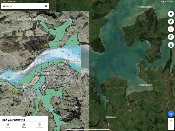 |
Posted By: Pannie_Dropper
Date Posted: 06 Mar 2023 at 1:57am
| And thanks for that link, very handy! |
Posted By: krow
Date Posted: 06 Mar 2023 at 7:51pm
|
If I remember I'll have a look on my C-map in my chart plotter when I'm out tomorrow to see if it has anything. |
Posted By: Crochet Cast
Date Posted: 06 Mar 2023 at 10:03pm
Navionics has some patchy coverage. 
|
Posted By: Crochet Cast
Date Posted: 06 Mar 2023 at 10:05pm
 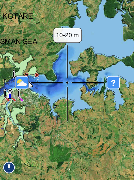
|
Posted By: krow
Date Posted: 07 Mar 2023 at 8:04pm
| C map stops same area as Navionics. |
Posted By: Pannie_Dropper
Date Posted: 07 Mar 2023 at 9:53pm
|
That would do - even some coverage is better that nothing. I’ve been doing a bit of investigation and it is possible to load satellite imagery for a specific area. It seems to be a process. I’m not sure if the back harbour is covered in this much details in the Navionics basemap coverage. It is there on the Navionics + however. If basemap gets re-instated on wet maps.co.nz I’ll have a look Thanks for the help everyone
|